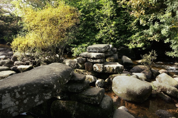
A packhorse clapper of five imposts[note 1], in use until superseded by the modern bridge.
Groves[note 2] says such clappers were of 13th Century origin, no doubt rebuilt many times.
It was washed out in 1826 and partially restored, as shown by Falcon[note 3].
As the hills close in, the trees begin.
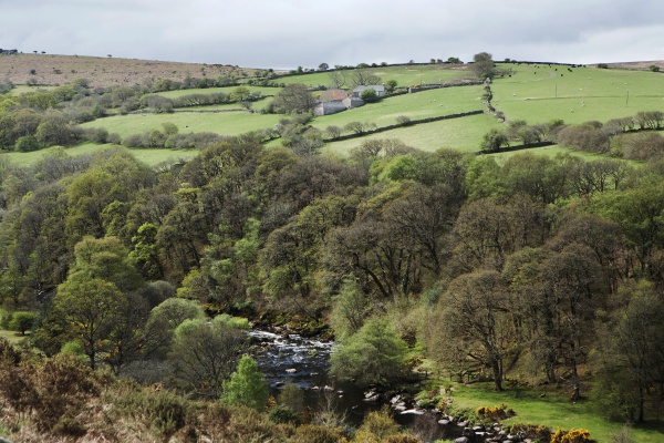
Viewed from the hillside above the gorge.

The tumble of boulders shown here sometimes comes right down to the river's edge and,
where the path has been washed out, are large enough to make scrambling across them unpleasant.

An autumn sun glimmers through the coloured leaves.

Large blocks of granite sheltering beneath a spring green canopy; these are beside the shelving riverbed seen next.

The Dart descends a series of rock ledges, like giant steps, on its way to Langamarsh and Eagle Rock.
There is pink granite everywhere, worn smooth by water and slippery when wet.

When not in spate (flood) the river water is crystal clear; but do not bathe:
the deeper pools have nasty undertows which, tradition says, captures a life each year.

Shapes in one of the ledges where picture 7 was taken.
Previous
Next
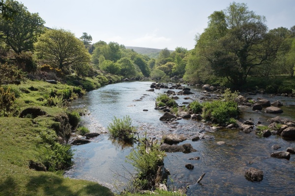
The two Dart rivers meet just downstream from the turnpike bridge at Dartmeet. Immediately
opposite their confluence on the left bank is a small field, on the moorland side of which
there is a path that continues downstream. Soon trees close in and the narrow flood-plain
disappears, replaced by a clitter-covered hillside that extends to Eagle Rock. The first
time this clitter (Dartmoor for boulder scree) reaches to the river, it has been turned
into paving of sorts, until another short and narrow flood-plain is reached. Soon both
banks steepen and the river begins a rapid descent over a series of rock ledges. The sounds
of tumbling waters reverberate across a path that here and there has succumbed to winter
floods and been washed out; the only way forward is a scramble up steep banks of tree
roots, followed by a bout of boulder hopping until the path resumes.
1. As claimed in High Dartmoor Land and Peoples p563, by E Hemery, Robert Hale, 1983.
2. In Gill Ed., Dartmoor - A new Study p187, David and Charles, 1970.
3. Plate 51 in Dartmoor Illustrated by T A Falcon, J G Commin, 1900.
